Mapnificent: simple tool, magnificent impact
Hi all,
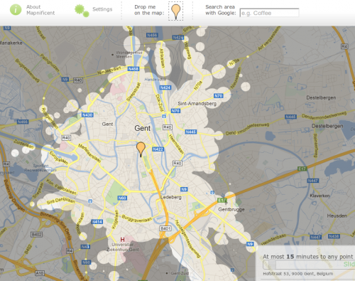
Meet Mapnificent. Mapnificent is a tool created by Stefan Wehrmeyer which maps the distances from a certain location to its surroundings. The interesting part about this is that the distance isn’t measured in kilometers or miles, but in minutes it would take you to go there using public transport.
Impact of open transport data
It is a simple tool, but the idea behind it is an opportunity for a million use-cases. Distance gets a new meaning: instead of looking for a job in a radius of 10km from where you live, you could be looking for a job you can reach by public transport in 15 minutes.
Current status
Currently De Lijn is the only Belgian dataset on mapnificent. Wouldn’t it be nice if we also could add NMBS/SNCB, MIVB/STIB and TEC? The technology is simple, an open data policy is apparently a little difficult to push through a Belgian organisation, sadly.
– Pieter


